

Lassen Volcanic National Park, located in Lassen County in northeastern California, is on the southern end of the Cascade Range. Lassen Peak last erupted in 1916, when Congress made this a national park. The eruptions started in May 1914 and forever changed the surrounding area. Lassen Peak, at 10,457 feet, was formed 27,000 years ago as a volcanic vent on the northern flank of Brokeoff Volcano.

Route 89 is the main road through the park. Within the park, there are many active volcanic features as well as areas deeply affected by past eruptions like “Devastated Area”. There are over 150 miles of hiking trails, 17 miles of which are part of the Pacific Coast Trail. There’s also plenty of backcountry areas, fishing, boating and hunting.


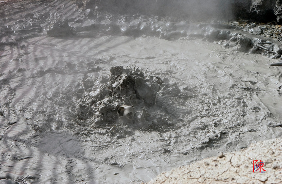
Our only hike during this visit was a short one into Bumpass Hell. Bumpass Hell is an area named after an early settler who severly burned his legafter falling into a boiling pool. The hike leads to an area that has the largest concentration of hydrothermic features in the park. The trail, only about a 3 mile roundtrip at an altitude of 8,000 feet, is a fairly easy one. At the end, there’s a 100 foot drop into the thermally active basin area. Sulphur is the dominant smell.


On this particular trip, we were looking for some fall foliage colors. Unfortunately, we were a bit early, off by maybe a week or two. The visit was in October, 2010. Some color was to be found by Manzanita Lake, which was about 30%. Additional color was found in the northern half of the park between Summit Lake and Manzanita Lake. More photos can be found at my Lassen Volcanic National Park gallery.